Construction Drone Monitoring in India: Progress Tracking, Surveys & Inspections
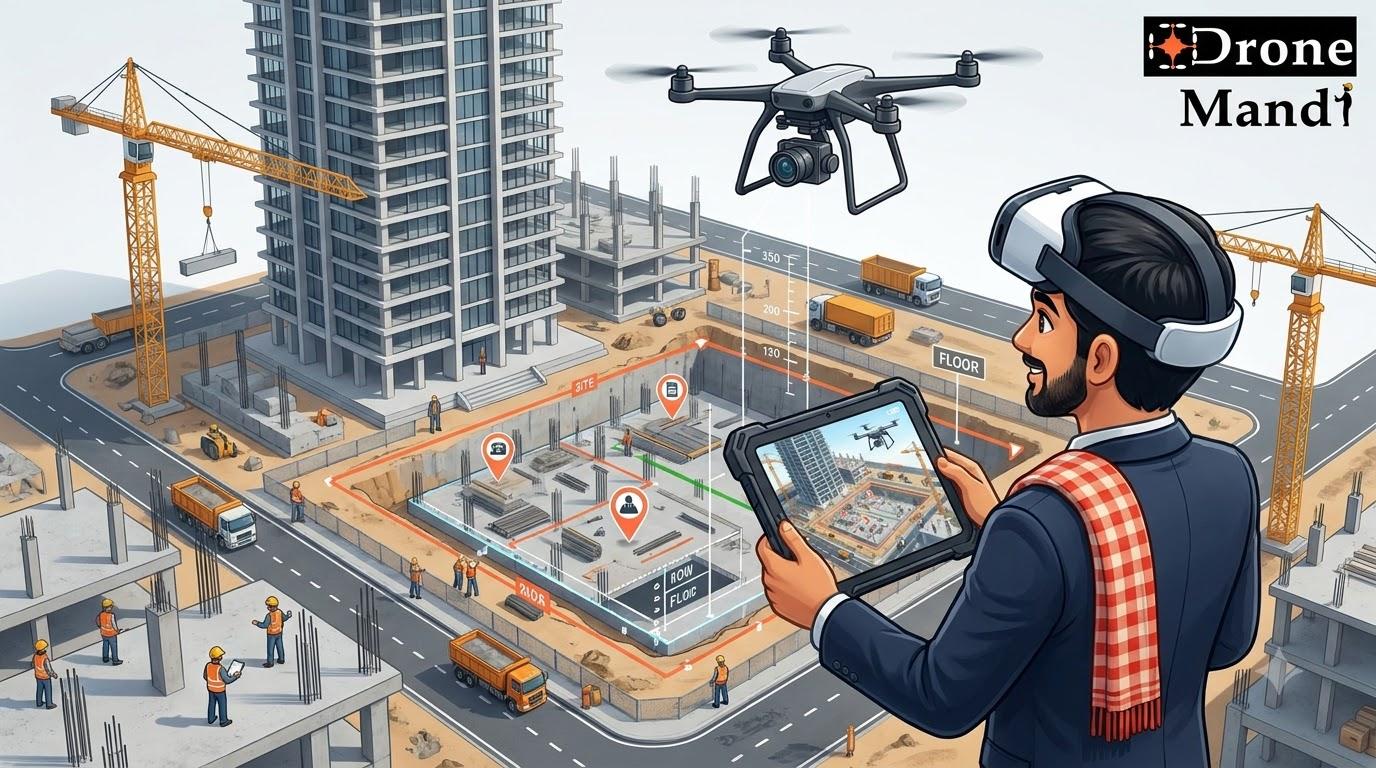
Construction Drone Monitoring in India: Progress Tracking, Surveys & Inspections
Construction projects are becoming larger, more complex and more data-driven. From residential towers and commercial buildings to highways, industrial facilities and large infrastructure projects, project teams need reliable information about what is happening on site.
Traditional site photographs and ground-based inspections are still important, but they may not provide a complete view of a large construction site. This is where construction drone monitoring in India is becoming increasingly useful.
A professional drone can capture aerial photographs, videos, survey data and other project information at regular intervals. When this information is collected systematically, construction companies can create a visual record of project progress and use aerial data to support planning, documentation, surveying and inspections.
What Is Construction Drone Monitoring?
Construction drone monitoring is the use of drones to regularly capture aerial information from a construction project.
Instead of relying only on photographs taken from ground level, a drone can provide a top-down and elevated view of the entire site.
Depending on the project requirement, drone monitoring can include:
- Aerial photographs
- High-resolution construction videos
- Progress documentation
- Site surveys
- Orthomosaic mapping
- 3D models
- Stockpile measurements
- Site inspections
- Construction documentation
- Time-series comparison
The exact output depends on the drone, camera, flight planning, survey requirements and software workflow used for the project.
Why Are Construction Companies Using Drones?
A construction site can change significantly from one week to another.
New floors are added, foundations are completed, roads are built, equipment moves around the site and construction materials are delivered or relocated.
Ground-level photographs may document individual areas well, but it can be difficult to understand the entire project from those images alone.
Aerial imagery provides a broader perspective.
For project managers, developers and contractors, regular drone flights can create a visual timeline of the site. This makes it easier to compare different stages of construction and communicate what has changed.
How Drones Are Used on Construction Sites
1. Construction Progress Monitoring
One of the most common applications is tracking construction progress.
A drone can capture aerial imagery at regular intervals, such as weekly, fortnightly or monthly depending on the project.
When images from different dates are compared, project teams can visually understand how the site has changed.
For example, a progress-monitoring program could document:
- Foundation work
- Structural construction
- Floor-by-floor progress
- Roof completion
- Road development
- Landscaping
- External infrastructure
- Material storage areas
This creates a consistent visual record rather than relying on photographs taken from different locations and angles each time.
2. Construction Site Survey
Drones can also be used for aerial surveying when the project requires suitable survey-grade workflows.
Depending on the equipment and methodology, drone survey projects can generate outputs such as orthomosaics, elevation information, point clouds and 3D models.
These outputs can support planning, measurement and project documentation.
For high-accuracy surveying, the workflow may require appropriate control points, RTK or PPK equipment and professional processing depending on the required accuracy.
3. Site Mapping
Large construction sites can be mapped using drone photogrammetry.
Multiple overlapping images are processed to create a larger aerial representation of the site.
Depending on the workflow, the resulting data may include:
- Orthomosaic maps
- Digital surface models
- Point clouds
- 3D terrain models
- Measurements
- Site boundaries and features
These outputs can provide a more complete picture of the construction environment than individual photographs.
4. Construction Inspection
Drones can capture imagery of elevated or difficult-to-access areas of a construction project.
This may include building facades, roofs, structural elements and other visible areas.
Drone imagery can help identify areas that may require closer inspection and can provide visual documentation for project teams.
Where an issue requires engineering assessment or physical testing, drone imagery should be treated as supporting information rather than automatically replacing the relevant professional inspection.
5. Documentation for Developers and Clients
Construction companies often need to communicate progress to developers, investors, clients and other stakeholders.
Aerial photographs and videos can make this communication much easier because they show the overall project rather than only individual site areas.
A monthly aerial progress report, for example, can provide stakeholders with a consistent visual understanding of project development.
6. Stockpile Measurement
Construction sites may contain large quantities of sand, aggregate, soil and other materials.
Drone surveying can be used to capture aerial data from stockpiles and, with an appropriate processing workflow, estimate their volume.
This can be useful for inventory management and site planning.
7. Road and Infrastructure Construction
Drones are particularly useful on large linear infrastructure projects.
Roads, highways, rail corridors, bridges and other infrastructure projects can cover large areas that are difficult to document comprehensively from the ground.
Regular aerial flights can provide project teams with an overview of construction progress across different sections of the project.
Construction Drone Monitoring vs Traditional Site Photography
| Factor | Traditional Ground Photography | Drone Monitoring |
|---|---|---|
| Perspective | Primarily ground-level | Aerial, elevated and top-down views |
| Large sites | Can require many photographs | Can capture broader site views efficiently |
| Progress comparison | Can vary by photographer and location | Can follow repeatable flight paths |
| Mapping | Limited | Can support photogrammetry and mapping workflows |
| Elevated structures | May require access equipment | Can capture imagery from the air |
| Site overview | Limited field of view | Wide aerial perspective |
Drone monitoring does not mean construction companies should stop taking ground photographs.
The two approaches can work together. Ground photography can capture close-up details while drone imagery provides the overall site perspective.
Benefits of Construction Drone Monitoring
Better Visibility of the Entire Site
A drone can provide a bird's-eye view of the construction project, allowing teams to see relationships between different parts of the site.
Consistent Progress Documentation
Regular flights can create a structured visual record that can be compared across different dates.
Faster Site Documentation
Aerial imagery can cover large areas without requiring a photographer to physically walk through every section of the site.
Improved Communication
Aerial photographs and videos can make project updates easier for clients and stakeholders to understand.
Useful Survey Data
When conducted using appropriate equipment and workflows, drone surveying can generate mapping and measurement outputs that support construction activities.
Better Documentation of Difficult Areas
Drones can capture imagery of elevated structures and other areas where direct visual access may be difficult.
Historical Project Record
Regular drone monitoring creates a visual archive of the construction project from early site preparation through completion.
How Often Should a Construction Site Be Monitored by Drone?
There is no universal schedule.
The right frequency depends on the size of the project, construction speed and purpose of the monitoring program.
| Project Requirement | Possible Monitoring Frequency |
|---|---|
| Fast-moving construction | Weekly or more frequently if required |
| General progress monitoring | Weekly to fortnightly |
| Large infrastructure | Scheduled by project milestones or sections |
| Monthly reporting | Approximately once per month |
| Special inspection | As required |
For many projects, consistency is more important than simply flying as frequently as possible.
If the drone is flown from substantially different locations, altitudes or camera angles every time, comparing the resulting imagery can become more difficult.
A professional monitoring workflow should therefore define the flight plan and expected deliverables in advance.
What Data Can a Construction Drone Capture?
The required data depends on whether the project is focused on documentation, surveying, mapping, inspection or a combination of these.
| Data Type | Potential Application |
|---|---|
| High-resolution photos | Site documentation and progress tracking |
| Aerial video | Project presentations and visual reporting |
| Orthomosaic | Site mapping and aerial measurement workflows |
| Point cloud | 3D visualization and surveying workflows |
| 3D model | Site visualization and documentation |
| Elevation data | Terrain and earthwork analysis |
| Thermal imagery | Certain specialized inspection applications |
Drone Construction Survey: What You Need to Know
Drone surveys are different from simply taking aerial photographs.
A survey project normally requires a defined methodology, suitable equipment, planned image overlap, appropriate ground control or positioning technology where required, and specialized processing.
Depending on the accuracy requirement, professional survey workflows may use RTK or PPK-enabled drones and ground control points.
The final accuracy depends on the entire workflow rather than the drone specification alone.
Factors such as camera calibration, flight altitude, image quality, overlap, positioning, ground control, terrain and processing methodology can all influence the result.
If your construction project requires measurements or survey-grade outputs, clearly communicate the required accuracy before hiring a drone service provider.
Using Drones for Construction Progress Reports
One of the strongest commercial applications of drone monitoring is creating recurring progress reports.
A typical workflow could look like this:
- Define the project area and monitoring requirements.
- Create a repeatable drone flight plan.
- Capture aerial imagery on the scheduled date.
- Process the imagery if required.
- Compare the current data with previous captures.
- Prepare photographs, videos, maps or other agreed deliverables.
- Share the progress documentation with project stakeholders.
Over several months, these reports can create a detailed visual history of the project.
Construction Drone Monitoring for High-Rise Projects
High-rise construction projects are particularly suitable for aerial documentation because the building changes significantly as new floors and external structures are completed.
Drones can capture:
- Overall building progress
- Facade development
- Roof progress
- Surrounding site conditions
- Material storage
- Access roads
- Construction equipment
- Site organization
The aerial perspective can complement close-range inspection and ground-level documentation.
Construction Drone Monitoring for Roads and Highways
Road and highway projects can extend over many kilometres, making traditional visual documentation challenging.
Drone operations can capture sections of the project from the air and provide a broader perspective of:
- Earthwork
- Road formation
- Bridges and structures
- Drainage work
- Intersections
- Construction camps
- Material storage
- Overall corridor progress
For large projects, the monitoring program should be designed around the project corridor, required outputs and applicable operational conditions.
Construction Drone Monitoring for Earthwork
Earthwork can involve significant movement of soil and other materials.
Drone surveying can provide useful aerial data for documenting the site and, where an appropriate survey workflow is used, supporting measurements of terrain and material volumes.
This can help project teams understand how the site has changed between different stages.
For measurement-critical applications, the required survey methodology and accuracy should be established before the flight.
How Much Does Construction Drone Monitoring Cost in India?
Construction drone monitoring does not have one fixed price in India.
A single aerial progress shoot for a small construction site is very different from a recurring monitoring program involving mapping, surveying and data processing.
| Service | Main Cost Factors |
|---|---|
| Basic aerial progress photography | Location, site size, flight time and deliverables |
| Construction aerial video | Drone, camera, flight complexity and editing requirements |
| Recurring monitoring | Frequency, site size and reporting requirements |
| Drone survey | Accuracy, area, equipment and processing |
| Drone mapping | Area, image acquisition, processing and required outputs |
| Thermal inspection | Specialized drone and sensor requirements |
For standard drone services in India, basic camera-drone assignments may often fall around ₹5,000–₹8,000 per session or approximately ₹9,000–₹13,000 per day depending on location and scope.
Advanced drones and specialized equipment can cost approximately 1.5–2 times standard drone rates, while FPV operations can start around ₹10,000 and increase substantially depending on the required shots and complexity.
These figures should be treated as practical planning ranges rather than fixed nationwide tariffs. Construction survey, mapping and inspection projects are generally better quoted according to the actual project scope.
What Determines Construction Drone Service Cost?
- Site area: Larger sites require more flight planning and data collection.
- Location: Travel requirements can affect the final quotation.
- Frequency: Recurring monitoring involves multiple site visits.
- Drone type: Professional and advanced platforms have different operating costs.
- Camera: High-resolution and specialized cameras can affect pricing.
- Survey requirements: RTK, PPK, GCPs and specialized processing can increase project complexity.
- Deliverables: Raw images, edited video, maps, models and reports may have different costs.
- Site conditions: Complex or restricted environments can require additional planning.
How to Hire a Drone for a Construction Site
Hiring a drone service for construction should start with the project requirement rather than simply searching for the cheapest drone operator.
Step 1: Define the Requirement
Decide whether you need:
- Progress photographs
- Construction videos
- Regular monitoring
- Site survey
- Drone mapping
- 3D model
- Stockpile measurement
- Inspection
- Thermal imagery
Step 2: Share the Site Location
Provide the exact project location and, where possible, the approximate site size.
Location is important for flight planning, operational feasibility and applicable regulatory requirements.
Step 3: Explain the Deliverables
Tell the service provider exactly what you expect after the flight.
For example, a client may need 30 edited photographs, raw aerial imagery, a four-minute progress video, an orthomosaic or a 3D model.
Step 4: Confirm the Drone and Equipment
Ask which drone and camera will be used and why they are suitable for your project.
A standard camera drone may be enough for progress photography, while survey or thermal applications may require specialized equipment.
Step 5: Confirm the Operator's Experience
Construction sites can be complex operating environments. Ask about the pilot's relevant experience and whether they have handled similar commercial projects.
Step 6: Discuss Safety and Permissions
The drone operator should evaluate the proposed operation and comply with applicable drone rules, airspace requirements and site-specific safety procedures.
Construction sites may also have their own access, PPE, security and operational requirements.
Step 7: Compare the Complete Scope
Compare quotations based on the entire service rather than only flight time.
Check whether the quotation includes travel, equipment, number of images, video editing, mapping, processing, reporting and other requested deliverables.
Why Book Construction Drone Services Through Drone Mandi?
Finding a drone operator who understands a construction requirement can be harder than simply finding someone with a camera drone.
A construction project may require photography, videography, surveying, mapping or inspection depending on the objective.
Drone Mandi is built as an Indian drone marketplace where customers can share their drone requirement and connect with drone professionals for different types of commercial work.
Whether you need a one-time construction progress shoot or a more specialized drone survey or inspection, the requirement can be communicated before selecting the appropriate drone professional.
Drone Mandi's broader drone-service ecosystem includes:
- Drone photography
- Drone videography
- Drone surveys
- Drone mapping
- Drone inspections
- Drone surveillance
- Construction monitoring
- Industrial drone services
- Custom drone requirements
This makes Drone Mandi useful for construction companies that may need different aerial services at different stages of a project.
Looking for a Drone for Your Construction Site?
Need construction progress monitoring, aerial photography, drone surveying, mapping, inspection or site documentation?
Drone Mandi helps customers connect with drone professionals for construction and other commercial drone requirements across India.
Share your project requirement and find the right drone service for your site.
Construction Drone Services in Major Indian Cities
Construction activity across India's major cities creates a wide range of opportunities for drone-based monitoring and documentation.
- Gurgaon: High-rise residential, commercial and corporate construction projects.
- Delhi: Infrastructure, redevelopment, commercial and institutional projects.
- Noida: Large residential developments, commercial projects and infrastructure.
- Bangalore: Technology campuses, residential developments and commercial construction.
- Mumbai: High-rise buildings, infrastructure and redevelopment projects.
- Pune: Residential, industrial and commercial construction.
- Chennai: Industrial, infrastructure and residential projects.
- Ahmedabad: Commercial, industrial and infrastructure development.
- Hyderabad: Large residential, commercial and technology-sector construction projects.
- Other Indian cities: Drone construction services can be arranged depending on operator availability and project requirements.
Common Mistakes When Hiring a Construction Drone Service
Choosing Only on Price
A low-cost drone flight may provide photographs but not the consistency, processing or deliverables required for meaningful construction monitoring.
Not Defining the Output
Before booking, specify whether you need photographs, videos, maps, models, measurements or inspection imagery.
Using Different Flight Conditions Every Time
Progress monitoring works best when the data is collected using a reasonably consistent methodology.
Assuming Every Drone Can Conduct a Survey
Surveying has different requirements from ordinary aerial photography. Accuracy requirements should be discussed before the project begins.
Ignoring Site Safety
Construction sites contain cranes, machinery, workers, structures and other potential hazards. Drone operations need proper planning around these conditions.
Not Planning Recurring Monitoring in Advance
If the purpose is monthly or weekly monitoring, establish the flight locations, angles, altitude, outputs and schedule from the beginning.
How Construction Drone Monitoring Can Improve Project Communication
One of the less obvious benefits of drone monitoring is communication.
A project manager may understand a site after spending hours on it, but a client or investor may not have that same context.
An aerial image can immediately show the scale and current condition of the project.
For example, a monthly report can contain:
- Current aerial photographs
- Comparison with the previous month
- Key construction milestones
- Overall site images
- Selected close-up photographs
- Short aerial video
This can make construction updates more visual and easier to understand.
Drone Monitoring and the Future of Construction
Construction is becoming increasingly dependent on digital information.
Drone data can contribute to this transition by creating consistent visual and geospatial information about a project.
Future construction workflows are likely to combine drone imagery with mapping platforms, 3D models, project-management systems, BIM workflows, analytics and other digital tools.
The long-term opportunity is therefore not simply replacing a photographer with a drone.
It is creating a repeatable aerial data layer for the construction project.
When captured consistently, drone data can become part of the project's historical record and support multiple teams across planning, construction, communication and documentation.
Frequently Asked Questions
What is construction drone monitoring?
Construction drone monitoring is the use of professional drones to regularly capture aerial photographs, videos, survey data or other information from a construction site for progress tracking, documentation, mapping and inspection.
How are drones used in construction?
Drones can be used for construction progress monitoring, aerial photography, site surveys, mapping, inspections, stockpile measurement, documentation and other project-specific applications.
How much does construction drone monitoring cost in India?
Cost depends on site size, location, monitoring frequency, drone equipment, survey requirements, processing and deliverables. Basic aerial shoots can be less expensive than recurring monitoring, mapping, surveying or specialized inspection projects.
Can drones monitor construction progress?
Yes. Regular aerial flights can create a visual timeline of construction progress and allow project teams to compare site conditions across different dates.
Can drones survey construction sites?
Yes. Drones can support construction surveying when appropriate equipment, flight planning, positioning, ground control and processing workflows are used for the required accuracy.
Can drones create 3D models of construction sites?
Yes. Overlapping drone imagery can be processed using photogrammetry workflows to create outputs such as 3D models and point clouds, depending on the project and processing methodology.
How often should a construction site be monitored by drone?
The frequency depends on the construction speed and monitoring objective. Projects may use weekly, fortnightly, monthly or milestone-based drone flights.
Can drones measure construction stockpiles?
Yes. With an appropriate drone surveying and processing workflow, aerial data can be used to estimate stockpile volumes and support material management.
Can drones inspect high-rise construction sites?
Yes. Drones can capture aerial imagery of high-rise construction projects, including elevated structures, facades, roofs and surrounding site areas, subject to safe and permitted operation.
How do I hire a drone for a construction site?
Share your construction site location, project size, required service and desired deliverables with a professional drone service provider. Drone Mandi can help customers connect with drone professionals for construction photography, monitoring, surveying, mapping and inspection requirements.
Conclusion
Construction drone monitoring is becoming a practical way for Indian construction companies to collect better aerial information about their projects.
From progress photography and stakeholder reporting to surveying, mapping, stockpile measurement and inspections, drones can support multiple stages of a construction project.
The biggest advantage comes from using drones systematically rather than treating every flight as a one-off photography assignment. A consistent monitoring program can create a valuable visual history of the project and provide aerial information that is difficult to obtain from the ground alone.
For construction companies, developers and contractors looking for a drone service in India, Drone Mandi provides a marketplace approach to finding drone professionals for construction monitoring, photography, surveying, mapping, inspection and other aerial requirements.
Need Drone Services?
Get in touch with us to book certified drone pilots anywhere in India.