
Drone Survey Services in India: Cost, Applications & How to Book
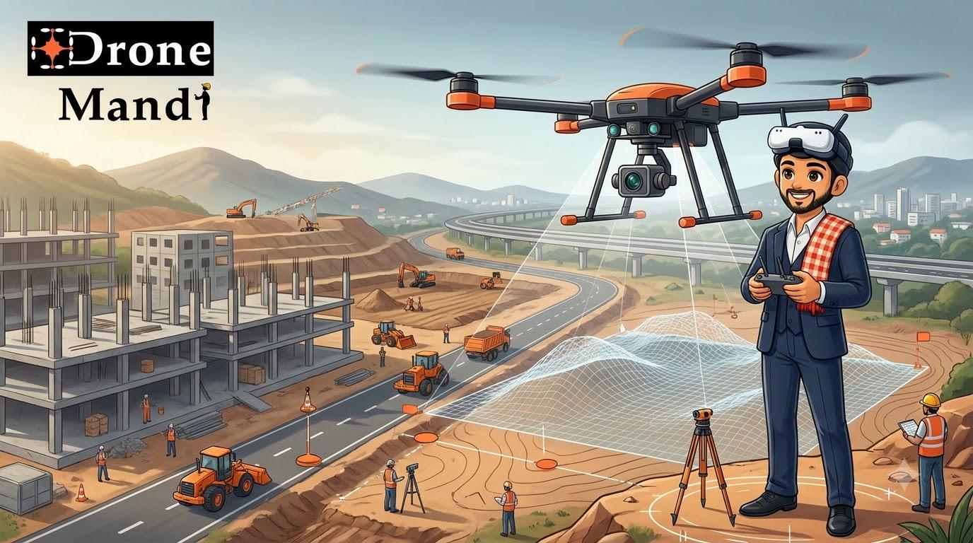
Drone Survey Services in India: Cost, Applications & How to Book
Surveying large areas has traditionally required significant amounts of time, manpower and equipment. Depending on the project, survey teams may need to walk across large sites, collect measurements from multiple locations and spend considerable time processing the information.
Drone survey services in India are changing how many construction, infrastructure, mining, land development and engineering projects collect aerial data.
A drone can cover a large area from the air while capturing a structured set of high-resolution images and other data. When these images are processed using appropriate photogrammetry or surveying workflows, they can be used to create outputs such as orthomosaics, point clouds, digital surface models, terrain models and measurements.
But a drone survey is not simply flying a drone over a site and taking photographs. The quality of the final survey depends on mission planning, image capture, ground control, camera quality, positioning, overlap, site conditions and data processing.
What Is a Drone Survey?
A drone survey is the process of collecting aerial data using an unmanned aircraft system and processing that data to generate useful geographic, engineering or measurement information.
The drone follows a planned flight path over the survey area and captures a series of overlapping images. Specialized software can then combine those images and generate different types of survey outputs.
Depending on the project, a drone survey may be used to understand:
- Land boundaries and site conditions
- Elevation and terrain
- Construction progress
- Stockpile volumes
- Road and infrastructure corridors
- Earthwork quantities
- Drainage and surface conditions
- Existing structures
- Development of large sites
The exact outputs depend on the survey methodology and the equipment used.
Why Use a Drone for Surveying?
1. Cover Large Areas Faster
A drone can capture imagery across a large site without requiring a survey team to physically walk through every portion of the area.
This can be particularly useful for construction sites, large land parcels, infrastructure projects and difficult terrain.
2. Create Detailed Aerial Data
Modern mapping drones can capture high-resolution imagery suitable for photogrammetry workflows. The resulting datasets can provide a detailed visual representation of the surveyed area.
3. Repeat the Survey Regularly
One of the biggest advantages of drone surveying for construction and infrastructure projects is repeatability.
The same site can be surveyed periodically to compare changes over time.
4. Improve Site Visibility
Aerial data provides a different perspective from ground-level measurements. Project managers can use aerial imagery to understand the overall condition and development of a site.
5. Reduce Manual Exposure to Difficult Areas
Certain areas can be difficult to access on foot. Drone-based data collection can sometimes reduce the amount of physical movement required across challenging terrain, subject to the project's requirements and safety considerations.
What Can a Drone Survey Produce?
A drone survey can produce different outputs depending on the camera, positioning technology, flight planning and processing workflow.
| Output | What It Represents |
|---|---|
| Orthomosaic | Geometrically corrected aerial image assembled from multiple photographs |
| Point Cloud | Large collection of 3D points representing surfaces and structures |
| Digital Surface Model | Elevation representation including visible surface features |
| 3D Model | Three-dimensional representation created from captured imagery |
| Contour Data | Lines representing changes in elevation |
| Volume Measurements | Estimated quantities such as stockpile or earthwork volumes |
Not every drone survey automatically produces every output listed above. The required deliverables should be agreed with the survey provider before the project begins.
Major Applications of Drone Surveying in India
Construction Site Surveys
Construction is one of the most practical applications of drone surveying.
A construction company can use repeated aerial surveys to document site conditions, monitor earthwork, compare progress and create updated visual records.
Drone surveys can also complement conventional site measurements by providing a broader aerial view of the project.
Land and Property Surveys
Large land parcels can be difficult to inspect entirely from ground level.
Aerial imagery can help project teams understand the existing condition of a property and generate mapping data for further analysis.
Topographic Surveys
Drone photogrammetry can be used to capture terrain information and generate elevation-based outputs for suitable projects.
These datasets can be useful during planning, development and engineering workflows.
Road and Highway Projects
Long linear infrastructure projects can benefit from aerial data because large corridors can be documented efficiently.
Drone surveys can assist teams in visualizing road alignments, construction progress, surrounding terrain and site conditions.
Mining and Quarry Surveys
Large mining and quarry sites can be challenging to survey regularly using only ground-based methods.
Drone mapping can help generate updated aerial datasets and can also support volume estimation workflows when appropriately planned and processed.
Stockpile Measurement
Construction and mining companies often need to understand quantities of material stored across a site.
Drone imagery can be processed into 3D data that supports stockpile volume calculations.
Industrial Sites
Large industrial facilities can use aerial surveys for documentation, planning, monitoring and asset visualization.
Drone Survey vs Traditional Survey
Drone surveying does not necessarily replace conventional surveying. In many professional projects, the two methods can complement each other.
| Factor | Drone Survey | Traditional Survey |
|---|---|---|
| Large-area coverage | Highly efficient for aerial data collection | Can require more ground movement |
| Visual documentation | Excellent aerial record | More ground-level focused |
| 3D reconstruction | Strong capability through photogrammetry | Depends on survey method |
| Repeated monitoring | Well suited to recurring site flights | Can require more field effort |
| High-precision control points | Can complement ground control workflows | Strong capability |
The right approach depends on the engineering requirements of the project. A drone survey provider should understand when aerial photogrammetry is appropriate and when additional conventional surveying methods are required.
How Accurate Is a Drone Survey?
Accuracy is one of the most misunderstood aspects of drone surveying.
There is no single accuracy number that applies to every drone survey.
Accuracy can depend on factors including:
- Drone and camera system
- Flight altitude
- Ground sampling distance
- Image quality
- Image overlap
- Ground control points
- RTK or PPK positioning
- Terrain and vegetation
- Lighting conditions
- Processing software and workflow
- Survey methodology
Therefore, customers should communicate their required accuracy and intended use before the survey is planned.
What Is RTK in Drone Surveying?
RTK, or Real-Time Kinematic positioning, is a positioning technology that can improve the positional accuracy of compatible drone systems.
RTK-enabled drones can be particularly useful for professional mapping and surveying projects where accurate positioning is important.
However, using an RTK drone does not automatically guarantee a specific final accuracy for every project. The complete survey workflow still matters.
What Are Ground Control Points?
Ground control points, commonly called GCPs, are identifiable points on the ground whose positions are measured using appropriate surveying methods.
These points can help establish a relationship between the aerial imagery and known ground coordinates during processing.
Whether GCPs are required depends on the project, equipment, accuracy requirements and processing methodology.
How Much Does Drone Survey Cost in India?
The cost of a drone survey in India can vary significantly because a small land survey and a large engineering project may require completely different equipment, planning and deliverables.
Unlike simple drone photography, survey pricing is usually driven by the technical scope of the project rather than just the number of hours the drone is in the air.
| Pricing Factor | Why It Matters |
|---|---|
| Survey area | Larger areas require more flight planning and data collection |
| Required accuracy | Higher requirements may need specialized equipment and workflows |
| Drone and sensors | Advanced systems can increase project cost |
| Ground control | Additional field work may be required |
| Data processing | Photogrammetry and 3D outputs require processing time |
| Deliverables | CAD, orthomosaic, point cloud, DSM and other outputs can affect pricing |
| Location | Travel and site logistics can affect the quotation |
Because of these variables, it is better to request a project-specific quotation rather than relying on a single “drone survey price per day.”
What Information Should You Give a Drone Survey Company?
The quality of the quotation depends heavily on the information provided at the beginning.
When requesting a drone survey, try to provide:
- Project location
- Approximate survey area
- Purpose of the survey
- Required outputs
- Required accuracy, if known
- Preferred survey date
- Site photographs or drawings
- Existing coordinates or reference data, if available
- Any access or operational restrictions
For example, saying “I need a drone survey” is much less useful than saying:
A detailed requirement allows the survey provider to propose a more appropriate workflow.
How the Drone Survey Process Works
1. Project Assessment
The survey team first understands the location, purpose, area and expected outputs.
2. Site and Flight Planning
The pilot plans the flight based on the site geometry, required image resolution, overlap, terrain and operational conditions.
3. Ground Preparation
Where required, the team may establish ground control points or other reference information.
4. Drone Data Capture
The drone follows the planned mission and captures overlapping imagery across the survey area.
5. Data Processing
The captured imagery is processed using appropriate photogrammetry or mapping software.
6. Quality Check
The resulting dataset should be reviewed for problems such as missing coverage, poor imagery, processing errors or other issues that could affect the intended output.
7. Final Deliverables
The client receives the agreed outputs in the required formats.
What Deliverables Can You Request?
Different projects require different deliverables. Before booking, clearly specify what you actually need.
- High-resolution orthomosaic
- Point cloud
- Digital surface model
- Digital terrain model where appropriate
- Contour maps
- 3D model
- Elevation information
- Volume calculations
- Raw aerial imagery
- Processed photographs
If you require CAD files, GIS-compatible outputs or specific coordinate systems, mention them before the project starts.
Drone Survey for Construction Projects
Construction companies are increasingly interested in drone surveys because the same site can be documented repeatedly throughout the project.
A construction drone survey can help teams monitor:
- Site development
- Earthwork
- Road formation
- Material stockpiles
- Structural progress
- Overall site conditions
- Project documentation
Repeated surveys can also create a visual timeline of the project, making it easier to compare the site at different stages.
This is particularly useful when project managers, contractors, investors or other stakeholders need a clear aerial view of ongoing development.
Drone Survey for Land Development
Before developing a large land parcel, project teams often need a clear understanding of the existing site.
Drone imagery can provide a detailed aerial record of the property and surrounding environment.
Depending on the project's requirements, processed drone data can support planning and engineering workflows involving terrain, roads, drainage, structures and land development.
Drone Survey for Mining and Stockpiles
Mining and material-handling operations can involve large stockpiles and constantly changing terrain.
A drone can periodically capture updated imagery that can be processed into 3D data.
When the survey methodology is appropriate, this data can be used to estimate stockpile volumes and monitor changes over time.
How to Choose the Right Drone Survey Provider
Choosing a drone survey provider should involve more than checking whether the company owns a drone.
Look at Previous Survey Work
Ask for examples of similar projects. A provider experienced in construction surveying may be better suited to a construction project than someone primarily focused on wedding photography.
Ask About the Equipment
Understand what drone and camera system will be used and whether RTK, PPK or other positioning workflows are relevant to your project.
Discuss Accuracy Before the Flight
If the project has specific accuracy requirements, communicate them before booking.
Confirm Deliverables
Do not assume that every survey provider automatically includes every possible mapping output.
Ask About Processing
Find out whether the quotation includes data processing or only aerial image capture.
Check Operational Requirements
The provider should understand the requirements applicable to the planned drone operation and site.
Why Book a Drone Survey Through Drone Mandi?
Finding the right drone professional for a technical survey can be difficult, especially when the requirement involves mapping, photogrammetry, construction or engineering data rather than simple aerial photography.
Drone Mandi connects customers with drone professionals for a range of commercial drone requirements, including drone surveys, mapping, inspections, construction monitoring, photography and other specialized services.
Instead of searching separately for a drone, pilot and service provider, customers can share their project requirement and look for a suitable professional for the job.
For a drone survey requirement, providing the project location, approximate area, purpose, required outputs and expected timeline helps create a much clearer requirement.
Looking for a Drone Survey Service?
Whether you need a land survey, construction survey, mapping project, stockpile measurement or aerial data collection, Drone Mandi helps you connect with drone professionals for your project.
Drone Survey Services Across India
Drone survey requirements exist across construction, infrastructure, real estate, mining, agriculture, industrial and land-development projects throughout India.
Customers can look for drone survey professionals in cities and regions including Delhi, Gurgaon, Noida, Mumbai, Pune, Bengaluru, Hyderabad, Chennai, Ahmedabad, Jaipur, Chandigarh, Kolkata and other parts of India, subject to pilot availability and project requirements.
For projects outside major cities, travel and logistics may form part of the final quotation.
Common Drone Survey Mistakes
Choosing a Provider Only Because They Own a Drone
Owning a drone does not automatically mean that someone has experience with professional surveying and photogrammetry.
Not Defining the Deliverable
A customer asking for “survey photos” may have a very different requirement from someone asking for an orthomosaic, point cloud or CAD-ready dataset.
Ignoring Accuracy Requirements
If accuracy matters to the project, it should be discussed before the flight rather than after the data has already been collected.
Assuming More Overlap Automatically Solves Everything
Image overlap is important, but successful photogrammetry depends on the complete mission and processing workflow. Terrain, lighting, image quality, camera settings and positioning can also affect the result.
Not Checking the Final Data
A survey should have a quality-control step to identify missing coverage or processing issues before the final dataset is delivered.
Frequently Asked Questions
What is a drone survey?
A drone survey uses an unmanned aircraft to capture aerial imagery and other data that can be processed into mapping and survey outputs such as orthomosaics, point clouds, elevation models, 3D models and measurements.
How much does a drone survey cost in India?
Drone survey pricing varies based on survey area, location, equipment, accuracy requirements, ground control, processing and required deliverables. A project-specific quotation is usually more useful than a single nationwide price.
What can a drone survey be used for?
Drone surveys can be used for construction monitoring, land development, topographic mapping, mining, stockpile measurement, roads, infrastructure and other applications requiring aerial geographic or visual data.
How accurate is drone surveying?
Accuracy depends on the drone, camera, positioning system, flight altitude, ground sampling distance, ground control, image quality, terrain and processing workflow. There is no single accuracy level that applies to every drone survey.
Do drone surveys require RTK?
Not every drone survey requires RTK. RTK can be valuable for projects where improved positioning is important, but the appropriate workflow depends on the project's accuracy requirements and methodology.
What are ground control points in drone surveying?
Ground control points are identifiable locations on the ground whose positions are measured using appropriate surveying methods. They can be used during processing to help establish geographic accuracy for suitable projects.
Can drones be used for construction surveys?
Yes. Construction companies can use drone surveys to document site conditions, monitor progress, measure suitable earthwork or stockpiles and create updated aerial datasets.
Can a drone survey measure land area?
Drone imagery and mapping data can be used to calculate areas and other measurements when the survey is appropriately planned and processed. The suitability depends on the project's accuracy and measurement requirements.
Can drones calculate stockpile volume?
Yes. Suitable drone imagery can be processed into 3D data that supports stockpile volume calculations. The reliability of the calculation depends on the survey methodology, reference surface and quality of the collected data.
Can Drone Mandi help me book a drone survey?
Drone Mandi helps customers connect with drone professionals for services including drone surveys, mapping, inspections, construction monitoring, photography and other commercial drone requirements.
Conclusion
Drone survey services in India are becoming an important tool for collecting aerial information across construction, infrastructure, land development, mining and industrial projects.
The real value of a drone survey is not simply the drone flight. It is the complete workflow from mission planning and data capture to positioning, processing, quality control and delivery of useful survey information.
Before booking a service, clearly communicate your project area, purpose, required accuracy and expected deliverables. This allows the drone survey provider to determine the appropriate equipment and methodology.
If you need a professional drone survey, mapping project, construction survey, stockpile measurement or another aerial data-collection service, Drone Mandi can help you find drone professionals for your requirement.
Share your project requirement with Drone Mandi and find drone professionals for surveying, mapping, construction, inspection and other commercial drone services.
Need Drone Services?
Get in touch with us to book certified drone pilots anywhere in India.